2022 flood fall update
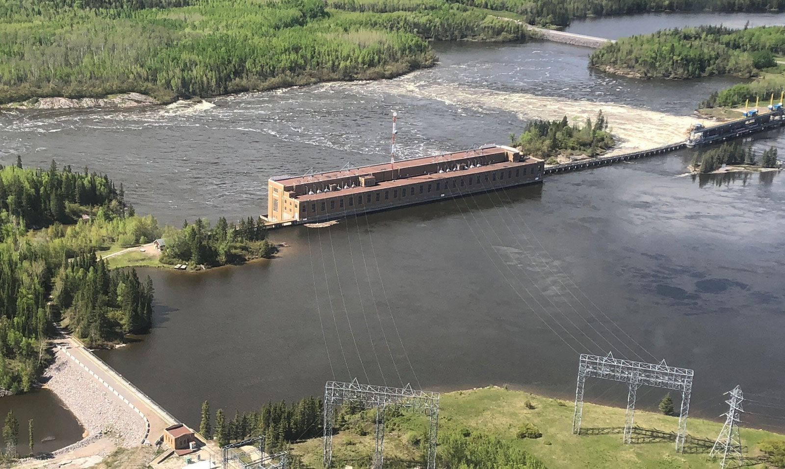
Slave Falls generating station passing high water on the Winnipeg River.
Enlarge image: Floodwaters surround roads and the hydroelectric generating station.
Water levels on Lake Winnipeg have been gradually falling since the mid-July peak of 717.5 feet above sea level (ASL) and are currently forecast to fall below 715 feet ASL prior to winter freeze-up in late fall.
High water levels on Lake Winnipeg are due to unprecedented spring flows into the lake across southern Manitoba, Northwest Ontario, and the northern US states, representing the highest volumes of water since records began in 1913. Last year, a large part of the same region was in drought.
At the end of May all the rivers flowing into Lake Winnipeg contributed to a peak inflow of over 450,000 cubic feet per second (CFS), primarily from the Winnipeg and Red rivers, both in flood stage. These exceptional inflows caused the level of Lake Winnipeg to rise more quickly than it has in recorded history – a full 5.5 feet in the six months between January and mid-July.
In July, the lake reached a peak level of 717.5 ft. ASL, the highest since the Lake Winnipeg Regulation project was completed in 1976.
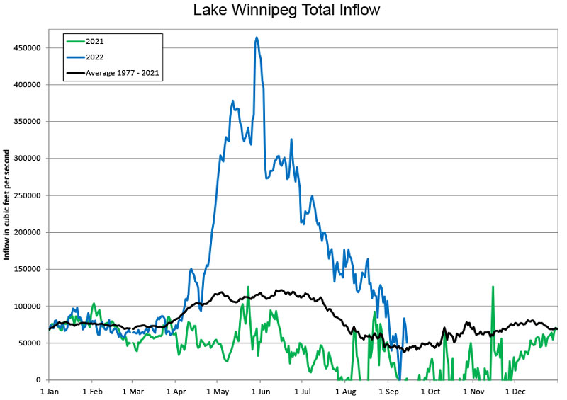
In 2022, the Lake Winnipeg total inflow rose faster than any other time in our history.
Enlarge image: Line chart compares the average, and the 2021 and 2022 water inflow in cubic feet.
These historic inflows to Lake Winnipeg during this year’s flood overwhelmed the capability of outflows, causing water levels to rise on the lake. The peak outflow for Lake Winnipeg was about 185,000 CFS during the mid-July peak level.
Prior to Lake Winnipeg Regulation (LWR), which increased the potential outflows from the lake by 50 per cent, the lake reached 718.2 ft. ASL in 1974 and 717.6 ft. ASL in 1966.
In response to a high winter snowpack, Manitoba Hydro ramped up outflows from Lake Winnipeg in January in anticipation of a heavy spring melt. Outflows were further increased through April and were at the maximum possible (“maximum discharge”) in May, following near record spring precipitation throughout the southern portion of the Lake Winnipeg basin. Outflows will remain at maximum discharge until lake levels fall below elevation 715 ft.