Burntwood, Lower Churchill, and Nelson rivers #3
Spring water outlook for northern Manitoba rivers
We provide water level and flow outlooks so communities have information on water conditions on the Churchill, Nelson and Burntwood rivers during the spring melt.*
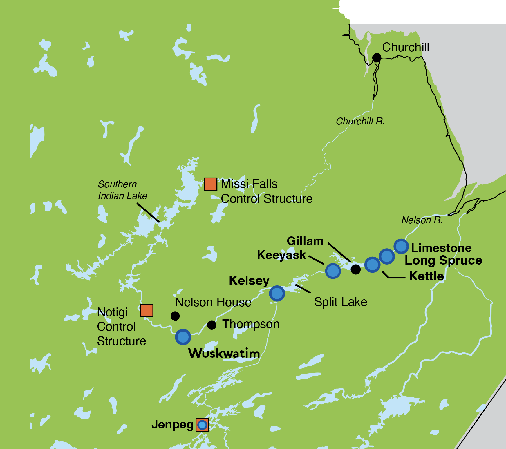
Map of Churchill and Nelson rivers with control structures and generating stations.
Enlarge image: Map of Churchill and Nelson rivers with control structures and generating stations.
Churchill River (Southern Indian Lake to Hudson Bay)
Spring melt started in early May with flows lower than last year but above average. Warm temperatures over the past week have resulted in a rapid increase in snowmelt runoff in the region. Churchill River flows at Churchill are estimated at approximately 38,800 cfs and are approaching the forecasted peak. Flows are anticipated to stabilize over the next week and begin to slowly decline. River ice break-up is currently underway, and water levels may be variable during this time.
Outflows through Missi Control Structure are 1,675 cfs, are following licence minimum winter releases and are projected to increase by the end of May. The timing and magnitude of these forecasted changes will be influenced by weather conditions and operations and are subject to change.
Burntwood River
Much of the Churchill River flow is diverted out of Southern Indian Lake through the Churchill River Diversion via the Notigi Control Structure to the Rat and Burntwood rivers. Flows through Notigi are at 28,100 cfs, which is lower than last year’s flow of 32,600 cfs.
Nelson River
Nelson River flows have peaked and will continue to decline over the next few weeks. Lake Winnipeg water level is 713.7 ft ASL and is expected to increase through May, remaining below average. Kelsey outflow is 75,500 cfs which is lower than last year’s 82,500 cfs. Split Lake water level is currently 549.3 ft ASL and is expected to gradually decline through the rest of May.
*Spring flows depend on how long it takes for snow to melt (i.e. warm temperatures will cause a fast melt and higher water flows; while cooler temperatures will cause a slow melt and moderate flows for a longer period of time). Conditions can also change rapidly if a large rainfall or snowfall event occurs. Outlook information will be updated as conditions change.
The Outlook is based on a combination of current and forecasted weather data from Environment and Climate Change Canada; recent and historic streamflow conditions based on both federal and Manitoba Hydro data; Manitoba Hydro regulation models for Reindeer Lake and Southern Indian Lake; snow surveys conducted by Manitoba Hydro; and snowpack estimates from satellite data.
If you have any questions or concerns, please contact:
Waterway Community Engagement
204-360-3505
WCE@hydro.mb.ca