
Burntwood, Churchill, and Nelson Rivers, spring 2026 #3
Spring water outlook for northern Manitoba Rivers
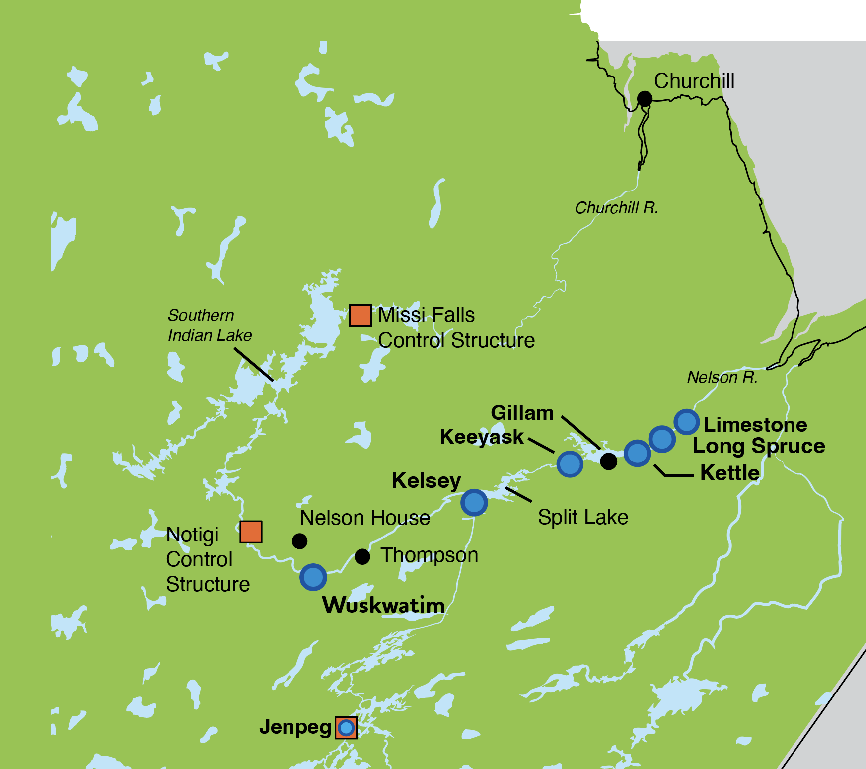
Map of Churchill and Nelson rivers with control structures and generating stations.
Enlarge image: Map of Churchill and Nelson rivers with control structures and generating stations.
Churchill River and Nelson River Basins
Spring melt has begun and will continue over the next few weeks. In the Burntwood, Churchill, and Nelson River areas, precipitation since October 2025 is near a 40-year high; however, total precipitation over the past year is at a 1 in 20-year low. Runoff from this winter’s above-average snowfall, combined with above-average precipitation since April 1, 2026, and lower than normal temperatures, is expected to support recovery from recent severe drought conditions.
Lower Churchill River (Southern Indian Lake to Hudson Bay)
Current inflows from Saskatchewan to Southern Indian Lake (SIL) are about 39,000 cubic feet per second (cfs) and are expected to continue to rise from spring melt.
The level of SIL is below average for this time of year at 843.9 ft and is expected to rise with the spring melt through late May and June.
Churchill River flows at CR30 are around 10,250 cfs and will slowly increase over the next few days, followed by a more rapid increase next week.
Outflows through the Missi Control Structure are around 1,750 cfs which is typical for this time of year and are expected to remain constant throughout spring.
The lower Churchill River remains iced-over and is expected to break up over the next few weeks. Average peak flows of about 98,800 cfs are expected near Churchill between late-May and early-June.
Burntwood River
Much of the Churchill River flow is diverted out of SIL through the Churchill River Diversion via the Notigi Control Structure to the Rat and Burntwood rivers. Flows through Notigi are currently about 24,600 cfs and are expected to rise to 34,900 cfs by early-to-mid summer.
Nelson River Basin
The Nelson River flow is at a 1 in 4-year low and is increasing. Lake Winnipeg is at 712.9 ft and remains at around a 1 in 8-year low level. Water levels on Cross Lake are expected to remain relatively stable, as outflow reductions at Jenpeg (to support storage recovery in Lake Winnipeg) offset increases in local inflow from snowmelt. Sipiwesk Lake level rose recently during the refilling of the Kelsey forebay.
Changes in precipitation affect Manitoba Hydro’s operations and water levels across the system. Manitoba Hydro closely monitors water supply conditions across the entire Nelson-Churchill River drainage basin and updates its forecasts and operating plans weekly to ensure adequate energy supply.
Long-term precipitation forecasts are unreliable, and there remains considerable uncertainty in water level projections for the late spring and summer period. Manitoba Hydro will continue to provide spring outlooks for the Lower Churchill, Burntwood and Nelson Rivers in the coming weeks.
The Outlook is based on a combination of current and forecasted weather data from Environment and Climate Change Canada; recent and historic stream flow conditions based on both federal and Manitoba Hydro data; Manitoba Hydro regulation models for Reindeer Lake and SIL; snow surveys conducted by Manitoba Hydro; and snowpack estimates from satellite data.
Note that spring flows depend on how long it takes for snow to melt (for example, warm temperatures will cause a fast melt and higher water flows, while cooler temperatures will cause a slow melt and moderate flows for a longer period of time). Conditions can also change rapidly if a large rainfall or snowfall event occurs. Outlook information will be updated as conditions change.
If you have any questions or concerns, please contact:
Waterway Community Engagement
204‑360‑3505
WCE@hydro.mb.ca