We develop materials to inform Manitobans about the process behind building and expanding our system and infrastructure. To receive federal and/or provincial approval for projects, detailed filings are submitted, which include environmental impact statements, community engagement materials, construction schedules, environmental protection and management plans.
As each project comes into service, these materials will be archived here.
Bipole III Transmission Project
Bipole III is a high voltage direct current transmission line that delivers renewable energy to southern Manitoba, helping to reduce reliance on fossil fuels. Completed in July 2018, Bipole III strengthens the reliability and security of Manitoba’s electricity supply.
Bipole III starts at the Keewatinohk converter station near Gillam in northern Manitoba. It travels 1,388 km south to end at the Riel converter station in the RM of Springfield.
Documents
View materials created for the Bipole III Transmission Project:
Regulatory approval & filings
Development of Bipole III required a Class 3 license under The Environment Act (Manitoba).
Manitoba Conservation and Climate (formerly Manitoba Sustainable Development) granted Environment Act Licence No. 3055 to Manitoba Hydro on August 14, 2013 for the construction, operation, and maintenance of the Bipole III Transmission Project. Read the Clean Environment Commission (CEC) report.
The project’s environmental assessment included an engagement process and identification of potential impacts and mitigation measures. It is documented in the Environmental Impact Statement (EIS).
Environmental Impact Statement
Environmental Impact Statement
December 2011
- Executive Summary (PDF, 73 KB)
- Chapter 1 - Introduction (PDF, 452 KB)
- Appendix 1A - Applicable Legislation (PDF, 148 KB)
- Appendix 1B - Scoping Document (PDF, 1.1 MB)
- Appendix 1C - Technical Reports (PDF, 219 KB)
- Maps (PDF, 2.1 MB)
- Chapter 2 - Need and Alternatives (PDF, 922 KB)
- Chapter 3 - Project Description (PDF, 62.8 MB)
- Appendices (PDF, 490 KB)
- Maps (PDF, 4 MB)
- Chapter 4 - Environmental Assessment Approach (PDF, 594 KB)
- Chapter 5 - Environmental Assessment Consultation Program (PDF, 771 KB)
- Appendix 5A - Newsletters (PDF, 3.8 MB)
- Appendix 5B - Meetings and Open Houses (PDF, 318 KB)
- Chapter 6 - Existing Environment (PDF, 1.4 MB)
- Appendix 6A - Biophysical Tables and Figures (PDF, 2.3 MB)
- Appendix 6B - Socio-Economic Tables and Figures (PDF, 1.3 MB)
- Maps (PDF, 120.5 MB)
- Chapter 7 - Identification and Evaluation of Alternative Routes and Sites (PDF, 492 KB)
- Appendix 7A - Preliminary Preferred Route Selection Process (PDF, 1.2 MB)
- Appendix 7B - Preliminary Preferred Route Adjustments (PDF, 70 KB)
- Maps (PDF, 12.9 MB)
- Chapter 8 - Effects Assessment and Mitigation (PDF, 1.4 MB)
- Maps (PDF, 7.8 MB)
- Chapter 9 - Cumulative Effects Assessment (PDF, 308 KB)
- Chapter 10 - Sustainability Assessment (PDF, 448 KB)
- Chapter 11 - Environmental Protection, Follow-up and Monitoring (PDF, 348 KB)
- Attachment 11-1 Draft Environmental Protection Plan (PDF, 2.6 MB)
- Abbreviations, Acronyms and Units (PDF, 232 KB)
- Glossary (PDF, 375 KB)
Technical reports
Technical reports
- Aboriginal Traditional Knowledge
- For Traditional Knowledge reports reach out to to the nation or organization directly.
- Agriculture (PDF, 7.1 MB)
- Aquatics (PDF, 12.9 MB)
- Appendix 1 (PDF, 112 KB)
- Appendix 2 (PDF, 112 KB)
- Appendix 3 (PDF, 30 KB)
- Appendix 4 (PDF, 209 KB)
- Appendix 5 (PDF, 4.7 MB)
- Appendix 6a 1–60 (PDF, 50 MB)
- Appendix 6b 61–119 (PDF, 48 MB)
- Appendix 6c 120–180 (PDF, 48 MB)
- Appendix 6d 181–280 (PDF, 50.1 MB)
- Appendix 6e 281–317 (PDF, 22.6 MB)
- Appendix 7a 1–24 (PDF, 29.1 MB)
- Appendix 7a 25–43 (PDF, 22.9 MB)
- Appendix 8 (PDF, 5.7 MB)
- Appendix 9 (PDF, 6.1 MB)
- Appendix 10 (PDF, 2.3 MB)
- Appendices 11–13 (PDF, 369 KB)
- Birds (PDF, 6.5 MB)
- Maps Part 1 (PDF, 17.7 MB)
- Maps Part 2 (PDF, 30.3 MB)
- Maps Part 3 (PDF, 33.8 MB)
- Maps Part 4 (PDF, 43 MB)
- Maps Part 5 (PDF, 39.6 MB)
- Maps Part 6 (PDF, 37.3 MB)
- Caribou (PDF, 3.5 MB)
- Map Series Part 1 (PDF, 33 MB)
- Map Series Part 2 (PDF, 43.6 MB)
- Map Series Part 3 (PDF, 21.1 MB)
- Economic Impact Assessment (PDF, 280 KB)
- Electromagnetic Fields (EMF) (PDF, 4.2 MB)
- Environmental Public Consultation (PDF, 11.8 MB)
- Forestry (PDF, 17.4 MB)
- GPS Reports (PDF, 2.3 MB)
- Greenhouse Gas Lifecycle Assessment (PDF, 1.3 MB)
- Groundwater (PDF, 10.1 MB)
- Habitat Fragmentation (PDF, 2.1 MB)
- Heritage (PDF, 10 MB)
- Lands of Special Interest and TLE (PDF, 16.5 MB)
- Land Use (PDF, 21.5 MB)
- Mammals (PDF, 2 MB)
- Maps Part 1 (PDF, 45.6 MB)
- Maps Part 2 (PDF, 39.5 MB)
- Maps Part 3 (PDF, 27.6 MB)
- Maps Part 4 (PDF, 25.8 MB)
- Resource Use (PDF, 12.5 MB)
- Socio-Economic (PDF, 16.4 MB)
- Appendix A (PDF, 15.8 MB)
- Appendix B Part 1 (PDF, 29.4 MB)
- Appendix B Part 2 (PDF, 12.1 MB)
- Appendix B Part 3 (PDF, 22.4 MB)
- Terrain and Soils (PDF, 2.6 MB)
- Terrestrial Ecosystems and Vegetation (PDF, 20.4 MB)
- Terrestrial Invertebrates Amphibians and Reptiles (PDF, 20.4 MB)
- Transportation (PDF, 9.3 MB)
Subsequent filings
Subsequent filings
February 2012
- Tourond Proposed Route Adjustment Consultation Report (PDF, 1.4 MB)
- Fox Lake Final Traditional Knowledge Report (PDF, 1.6 MB)
- Related maps (PDF, 200 KB)
- Southern Ground Electrode Line Route Selection Report (PDF, 660 KB)
July - September 2012
On August 8, 2012, Manitoba Hydro filed a supplementary report on caribou with the Manitoba Clean Environment Commission and Manitoba Conservation and Climate (formerly Manitoba Sustainable Development) in support of the Bipole III Environmental Impact Statement.
Supplemental Caribou Technical Report August 2012.
On July 31, 2012, Manitoba Hydro filed supplementary materials with the Manitoba Clean Environment Commission and Manitoba Conservation and Climate (formerly Manitoba Sustainable Development) in support of the Bipole III Environmental Impact Statement.
August 28, 2012, Environment Act Licence for Keewatinoow Lagoon received by Manitoba Conservation and Climate (formerly Manitoba Sustainable Development) (PDF, 6.2 MB)
September 12, 2012 filings - supplemental materials at the request of the Clean Environment Commission.
- Letter of submission to CEC (PDF, 387 KB)
- Maps associated with the Agricultural Technical Report
- Map Series List (PDF, 21 KB)
- Agriculture Map Series
- Fox Lake Cree Nation Position Paper (PDF, 213 KB)
- Project Description Update (PDF, 582 KB)
- Repeater Station Update (PDF, 1.1 MB)
- Pre-Construction Plant Survey Update (PDF, 21 KB)
Route adjustment fillings
Route adjustment fillings
On January 28, 2013, we submitted a supplemental assessment report on 3 route adjustments to Manitoba Conservation and Climate (formerly Manitoba Sustainable Development). The report outlined the environmental assessment undertaken at the request of Manitoba Conservation and Climate for the 3 route adjustments and was the focus of review at the Clean Environment Commission Public Hearings that were held in early March 2013.
- Supplemental Environmental Assessment Report. (PDF, 17 MB)
- Moose Meadows Area Adjusted Final Preferred Route Map (PDF, 371 KB)
- GHA19A and GHA14A Adjusted Final Preferred Route Map (PDF, 522 KB)
- Wabowden Area Adjusted Final Preferred Route Map (PDF, 446 KB)
On February 19, 2013, we filed the following supplemental material with Manitoba Conservation and Climate (formerly Manitoba Sustainable Development):
- Additional Meeting Notes (PDF, 78 KB);
- Wuskwi Sipihk Traditional Land Use and Occupancy Report (PDF, 246 KB).
Environmental protection
The Environmental Protection Program (EPP) for the Bipole III Project prescribed mitigation and protection measures to avoid and reduce potential environmental and social effects.
As part of the regulatory review, a table (PDF, 862 KB) was submitted to the Clean Environment Commission and to Manitoba Conservation and Climate (formerly Manitoba Sustainable Development) outlining all the mitigation measures that were indicated in the Environmental Impact Statement for the Project.
Project environmental protection plans
- Environmental Protection Plan (PDF, 2.7 MB)
- Culture and Heritage Resources Protection Plan (PDF, 1.8 MB)
- Integrated Vegetation Management Plan (PDF, 677 KB)
- Construction Environmental Protection Plan Transmission Section Index Maps
Construction environmental protection plans
- Riel Converter Station and Ground Electrode (PDF, 2.3 MB)
- AC Collector Lines, Construction Power Line and Station (PDF, 5.0 MB)
- Maps 1 to 3 (PDF, 4.1 MB)
- Maps 4 to 8 (PDF, 4.2 MB)
- Maps 9 to 12 (PDF, 4.2 MB)
- Maps 13 to 15 (PDF, 5.3 MB)
- Keewatinohk Converter Station and Ground Electrode (PDF, 9.3 MB)
- Maps 1 to 5 (PDF, 2.6 MB)
- Maps 6 to 8 (PDF, 3 MB)
- Transmission Line Construction Environmental Protection Plan (PDF, 3 MB)
- Transmission Line Segment N1 Mapbook
- Maps 1 to 4 (PDF, 4.6 MB)
- Maps 5 to 12 (PDF, 4.5 MB)
- Maps 13 to 21 (PDF, 4.5 MB)
- Maps 22 to 29 (PDF, 4.7 MB)
- Maps 30 to 39 (PDF, 4.2 MB)
- Maps 40 to 46 (PDF, 4.1 MB)
- Maps 47 to 54 (PDF, 4.6 MB)
- Maps 55 to 60 (PDF, 4.8 MB)
- Transmission Line Segment N2 Mapbook
- Maps 61 to 64 (PDF, 4.6 MB)
- Maps 65 to 70 (PDF, 4.3 MB)
- Maps 71 to 75 (PDF, 4.6 MB)
- Maps 76 to 82 (PDF, 4.6 MB)
- Maps 83 to 89 (PDF, 4.3 MB)
- Maps 90 to 100 (PDF, 4.6 MB)
- Maps 101 to 107 (PDF, 4.2 MB)
- Maps 108 to 111 (PDF, 2.8 MB)
- Transmission Line Segment N3 Mapbook
- Maps 111 to 113 (PDF, 3.9 MB)
- Maps 114 to 118 (PDF, 3.8 MB)
- Maps 119 to 123 (PDF, 3.8 MB)
- Maps 124 to 129 (PDF, 3.6 MB)
- Maps 130 to 136 (PDF, 4.0 MB)
- Maps 137 to 144 (PDF, 4.3 MB)
- Maps 145 to 149 (PDF, 3.4 MB)
- Maps 150 to 154 (PDF, 4.0 MB)
- Maps 155 to 158 (PDF, 3.0 MB)
- Transmission Line Segment N4 Mapbook
- Maps 158 to 162 (PDF, 4.3 MB)
- Maps 163 to 172 (PDF, 4.5 MB)
- Maps 173 to 182 (PDF, 4.7 MB)
- Maps 183 to 191 (PDF, 4.5 MB)
- Maps 192 to 201 (PDF, 4.6 MB)
- Maps 202 to 207 (PDF, 2.1 MB)
- Transmission Line Segment C1 Mapbook
- Maps 207 to 212 (PDF, 4.4 MB)
- Maps 213 to 220 (PDF, 4.4 MB)
- Maps 221 to 232 (PDF, 4.7 MB)
- Maps 233 to 240 (PDF, 2.8 MB)
- Transmission Line Segment C2 Mapbook
- Maps 240 to 251 (PDF, 4.7 MB)
- Maps 252 to 262 (PDF, 4.5 MB)
- Maps 263 to 270 (PDF, 2.3 MB)
- Transmission Line Segment S1 Mapbook
- Maps 270 to 276 (PDF, 4.4 MB)
- Maps 277 to 286 (PDF, 4.5 MB)
- Maps 287 to 292 (PDF, 4.4 MB)
- Maps 293 to 302 (PDF, 4.4 MB)
- Maps 303 to 306 (PDF, 1.4 MB)
- Transmission Line Segment S2 Mapbook
- Maps 306 to 315 (PDF, 4.7 MB)
- Maps 316 to 324 (PDF, 4.6 MB)
- Maps 325 to 331 (PDF, 4.1 MB)
- Maps 332 to 340 (PDF, 4.5 MB)
- Maps 341 to 343 (PDF, 1.3 MB)
- Transmission Line Segment N1 Mapbook
Access management plans
- Construction Access Management Brochure (PDF, 381 KB)
- Construction Keewatinoow Converter Station (PDF, 1 MB)
- Construction Transmission Line Access (PDF, 3.3 MB)
- Map 1 to 6 (PDF, 4.6 MB)
- Maps 7 to 14 (PDF, 4.6 MB)
- Maps 15 to 20 (PDF, 3.8 MB)
Annual harvest plans
- Keewatinoow Converter Station Facilities, Infrastructure and Ground Electrode;
- Transmission Line (PDF, 417 KB)
- Maps 1 to 7 (PDF, 4.3 MB)
- Maps 8 to 12(PDF, 4.3 MB)
- Maps 13 to 17(PDF, 4.0 MB)
- Maps 18 to 25 (PDF, 4.2 MB)
- Maps 26 to 33 (PDF, 4.6 MB)
- Maps 34 to 39 (PDF, 3.9 MB)
- Maps 40 to 45 (PDF, 4.4 MB)
- Maps 46 to 52 (PDF, 4.1 MB)
- Maps 53 to 58 (PDF, 4.3 MB)
- Maps 59 to 67 (PDF, 4.3 MB)
- Maps 68 to 76 (PDF, 4.4 MB)
- Maps 77 to 86 (PDF, 4.2 MB)
- Maps 87 to 95 (PDF, 3.8 MB)
Annual monitoring reports
- Biophysical monitoring plans and reports
- Biophysical Monitoring Plan (PDF, 1.5 MB)
- 2023 Environmental Monitoring
- Mammals monitoring program technical report 2023 (PDF, 7.6 MB)
- 2020 Environmental Monitoring
- Avian collision report 2018–2020 (PDF, 15.1 MB)
- Avian species of conservation concern monitoring report 2014–2020 (PDF, 31.7 MB)
- Mammals monitoring program technical report 2020 (Part A) (PDF, 81.6 MB)
- Mammals monitoring program technical report 2020 (Part B) (PDF, 41.5 MB)
- Terrestrial ecosystems and vegetation environmental monitoring 2020 (PDF, 1.9 MB)
- Vegetation monitoring survey 2021 (PDF, 1.6 MB)
- 2019 Environmental Monitoring
- Avian Monitoring Report 2019 (PDF, 5.6 MB)
- Mammals Monitoring Program Technical Report 2019 (Part A – Part 1) (PDF, 30.5 MB)
- Mammals Monitoring Program Technical Report 2019 (Part A – Part 2) (PDF, 38.9 MB)
- Mammals Monitoring Program Technical Report 2019 (Part B – Part 1) (PDF, 13.4 MB)
- Mammals Monitoring Program Technical Report 2019 (Part B – Part 2) (PDF, 2.4 MB)
- Terrestrial Ecosystems and Vegetation 2019 (PDF, 6.8 MB)
- 2018 Environmental Monitoring
- Avian Monitoring Report 2018 (PDF, 20.8 MB)
- Watercourse Crossings Post-construction Monitoring Report (PDF, 23.5 MB)
- Mammals Monitoring Program Technical Report (Part 1) (PDF, 21.3 MB)
- Mammals Monitoring Program Technical Report (Part 2) (PDF, 1.9 MB)
- Mammals Monitoring Program Technical Report (Part 3) (PDF, 14.1 MB)
- Terrestrial Ecosystems and Vegetation Environmental Monitoring (PDF, 4.7 MB)
- Soil Productivity Monitoring for Agricultural Lands 2018 (PDF, 1.7 MB)
- 2017 Summary of Environmental Monitoring (PDF, 13.4 MB)
- Avian Monitoring Report 2017 (PDF, 37.2 MB)
- Watercourse Crossings Post-construction Monitoring Report (PDF, 24.1 MB)
- Mammals Monitoring Program Technical Report (Part 1) (PDF, 30.1 MB)
- Mammals Monitoring Program Technical Report (Part 2) (PDF, 3.5 MB)
- Mammals Monitoring Program Technical Report (Part 3) (PDF, X MB)
- Terrestrial Ecosystems and Vegetation Environmental Monitoring (PDF, 5.1 MB)
- Permafrost and Surface Temperature Change Detection Analysis 2017 (PDF, 123 MB)
- Soil Productivity Monitoring for Agricultural Lands 2017 (PDF, 75 MB)
- 2016 Summary of Environmental Monitoring (PDF, 15.7 MB)
- Watercourse Crossing Post-construction Monitoring 2016 (PDF, 19.1 MB)
- Mammal Monitoring Technical Report (Part 1) (PDF, 24 MB)
- Mammal Monitoring Technical Report (Part 2) (PDF, 34.1 MB)
- Mammal Monitoring Technical Report (Part 3) (PDF, 44.4 MB)
- Prairie Skink Surveys 2016 (PDF, 3.2 MB)
- Permafrost Monitoring Surface Temperature Change Detection Analysis (PDF, 30 MB)
- Soil Productivity Monitoring for Agricultural lands (Part 1) (PDF, 3.9 MB)
- Soil Productivity Monitoring for Agricultural Lands (Part 2) (PDF, 40 MB)
- Terrestrial Ecosystems and Vegetation Pre-construction and Environmental Monitoring Annual Technical Report (PDF, 4.5 MB)
- 2015 Biophysical Monitoring and Mitigation Report (PDF, 3.4 MB)
- 2014 Biophysical Monitoring and Mitigation Report (PDF, 2 MB)
- Socio-economic monitoring plans and reports
- Socio-economic Monitoring Plan (PDF, 3 MB)
- Socio-economic monitoring program summary report (PDF, 1.4 MB)
- 2018 Socio-economic Monitoring Report (PDF, 1.4 MB)
- 2017 Socio-economic Monitoring Report (PDF, 1.6 MB)
- 2016 Socio-economic Monitoring Report (PDF, 1.4 MB)
- 2015 Socio-economic Monitoring Report (PDF, 1.1 MB)
- 2014 Socio-economic Monitoring Report (PDF, 709 KB)
- Electric and magnetic field effects monitoring report (PDF, 4.4 MB)
Community meetings
Discussions regarding monitoring and mitigation are ongoing. Methods of engagement and summaries of information from meeting minutes with communities were published on the public registry.
Newsletters
- Newsletter 1 (PDF, 532 KB)
- Newsletter 2 (PDF, 401 KB)
- Newsletter 3: Round 3 - Alternative Route Selection (PDF, 793 KB)
- Newsletter 4: Round 4 - Preliminary Preferred Route (PDF, 1.9 MB)
EMF
- DC Lines and Electronic Devices (PDF, 1.1 MB)
- Alternating Current Electric and Magnetic Field (PDF, 943 KB)
- Direct Current Electric and Magnetic Fields (PDF, 532 KB)
GIS data – project infrastructure for download
This zip file contains spatial files in ESRI Shapefile format of the permanent project infrastructure. They are viewable using geographic information system software. We recommend extracting the files to your computer, rather than opening them online. The .kml file will allow you to view the route(s) with software such as Google Earth®.
- Project components (Zip file, 2.6 MB)
Contact us
- Email the Bipole III Transmission Project.
- Phone 204‑360‑7888 or toll-free 1‑877‑343‑1631
- Mail
Manitoba Hydro
Bipole III Transmission Project
360 Portage Ave.
Winnipeg MB R3C 0G8
Birtle Transmission Project
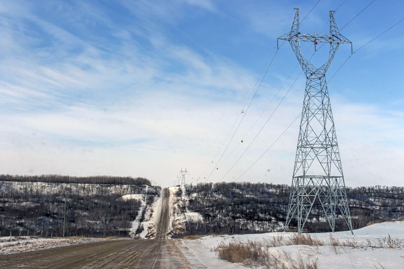
The Birtle Transmission Project crossing the Birdtail River along PTH 568.
Enlarge image: Transmission towers line a snowy road near the Birdtail River.
The Birtle Transmission Project built a 230-kV transmission line from Birtle Station, south of the community of Birtle, to the Manitoba–Saskatchewan border. SaskPower was responsible for building the transmission line in Saskatchewan that connects to their station in Tantallon, SK.
The project began with public and Indigenous engagement in fall 2016 to spring 2017. The line was energized March 29, 2021 to begin transmitting power to Saskatchewan. We received a Class 2 Development Licence (Licence #3314) under The Environment Act (Manitoba) on January 14, 2020. Construction started in July 2020 and the project was completed in March 2021.
Document library
View materials created for the Birtle Transmission Project:
Environmental protection and management plans
These plans were used as guides for contractors and field personnel during the construction of the Birtle Transmission Project. They helped us meet environmental legislation requirements and protect the environment.
- Access management plan (PDF, 3.1 MB)
- Access management plan mapbook (PDF, 21.9 MB)
- Biosecurity management plan (PDF, 6.1 MB)
- Construction environmental plan (PDF, 19.7 MB)
- Construction environmental protection plan mapbook (PDF, 20.7 MB)
- Cultural and heritage resources protection plan (PDF, 4.8 MB)
- Environmental monitoring plan (PDF, 958 KB)
- Grasslands offset plan for impacts to grassland bird habitat in the Spy Hill–Ellice Community Pasture (PDF, 4.7 MB)
Annual monitoring reports
- Environmental monitoring report 2023 (PDF, 1 MB)
- Environmental monitoring report 2022 (PDF, 6.2 MB)
- Vegetation technical report 2022 (PDF, 1.6 MB)
- Sharp-tailed grouse technical report 2022 (PDF, 1.3 MB)
- Bird species of conservation concern technical report 2022 (PDF, 4.8 MB)
- Mammals technical report 2022 (PDF, 192 KB)
- Environmental monitoring report 2021 (PDF, 3.2 MB)
- Stream crossing technical report 2021 (PDF, 1.5 MB)
- Vegetation technical report 2021 (PDF, 20.9 MB)
- Sharp-tailed grouse technical report 2021 (PDF, 3.4 MB)
- Bird species of conservation concern technical report 2021 (PDF, 2.7 MB)
- Environmental monitoring report 2020 (PDF, 2.8 MB)
- Invasive vegetation technical report 2020 (PDF, 2 MB)
- Sharp-tailed grouse lek technical report 2020 (PDF, 2.3 MB)
Culture and heritage monitoring report
- Culture and heritage monitoring report 2021 (PDF, 1.8 MB)
Final preferred route maps
Localized final preferred route maps:
- Map index (PDF, 3.3 MB)
GIS data – project infrastructure for download
This zip file contains spatial files in ESRI Shapefile format of the project infrastructure. They are viewable using geographic information system software. We recommend extracting the files to your computer, rather than opening them online. The .kml file will allow you to view the route(s) with software such as Google Earth®.
- Project components (Zip file, 1.6 MB)
Round 2 (2017)
- Newsletter: Preferred Route (PDF, 427 KB)
- Advertisement (PDF, 114 KB)
-
Alternating Current – Electric Magnetic Fields (PDF, 390 KB)
- Alternating Current Lines and Electronic Devices (PDF, 380 KB)
- Health Canada - Electric and Magnetic Fields from Power Lines and Electrical Appliances (PDF, 2 MB)
- Cattle & EMF (PDF, 45 KB)
- International Commission on Non-ionizing Radiation Protection (PDF, 121 KB)
- Right of Way - Tree Clearing and Maintenance (PDF, 1 MB)
- Keeping power lines clear of trees (PDF, 1.4 MB)
- Biosecurity and Transmission Lines (PDF, 1.3 MB)
- Public Open House storyboards (PDF, 418 KB)
- Landowner questionnaire (PDF, 46 KB)
Preferred route maps
- Map index (PDF, 496 KB)
Round 1 (2016)
- Map: Alternative routes segments and border connection zones (PDF, 1.1 MB)
- Newsletter: Alternative routes and potential border crossings (PDF, 746 KB)
- Transmission line routing process (PDF, 1.2 MB)
- Postcard – November 2016 (PDF, 127 KB)
- Public Open House storyboards (PDF, 346 KB)
- Survey/feedback form (PDF, 58 KB)
-
Map index (PDF, 3.7 MB)
- Map 1 – southeast area (PDF, 3.9 MB)
- Map 2 – southwest area (PDF, 4.1 MB)
- Map 3 – northeast area (PDF, 3.7 MB)
- Map 4 – northwest area (PDF, 4.2 MB)
Environmental assessment
An environmental assessment was submitted to Manitoba Conservation and Climate for review and approval was received. This project was classified as a Class 2 development under The Environment Act (Manitoba).
The EA report for the project included:
- a description of the project, through construction, operation, and maintenance;
- study area characterization through fieldwork and background investigation;
- outline the public and indigenous engagement processes, and the feedback received;
- identification and assessment of potential environmental and socio-economic effects; and
- development of mitigation measures to minimize potential effects on people and the environment.
Environmental Assessment Report – January 30, 2018
- Executive summary and contents (PDF, 642 KB)
- Chapter 1 – Introduction (PDF, 461 KB)
- Chapter 2 – Project description (PDF, 515 KB)
- Chapter 3 – Public engagement process (PDF, 641 KB)
- Chapter 4 – Indigenous engagement process (PDF, 3.5 MB)
- Chapter 5 – Existing environment (PDF, 8.8 MB)
- Chapter 6 – Routing process (PDF, 2 MB)
- Chapter 7 – Environmental assessment (PDF, 1.8 MB)
- Chapter 8 – Effects of the environment on the project (PDF, 59 KB)
- Chapter 9 – Accidents and malfunctions (PDF, 155 KB)
- Chapter 10 – Environmental protection follow-up and monitoring (PDF, 420 KB)
- Chapter 11 – Environmental assessment summary (PDF, 120 KB)
- Chapter 12 – References (PDF, 158 KB)
Appendices
- Appendix A – Transmission line routing (PDF, 5.9 MB)
- Appendix B – Public engagement information (PDF, 4.4 MB)
- Appendix C – Indigenous engagement summary (PDF, 224 KB)
- For Traditional Knowledge reports reach out to to the nation or organization directly.
- Appendix D – Biophysical technical report (PDF, 12.3 MB)
- Appendix E – Socioeconomic information (PDF, 148 KB)
- Appendix G – Draft construction environmental protection plan (PDF, 3.2 MB)
- Appendix G – CENVPP map book maps 1–7 (PDF, 4.7 MB)
- Appendix G – CENVPP map book maps 8–15 (PDF, 4.3 MB)
- Appendix G – CENVPP map book maps 16–24 (PDF, 4.8 MB)
- Appendix G – CENVPP map book maps 25–29 (PDF, 3.5 MB)
- Appendix H – Cultural and heritage resources protection plan (PDF, 4.2 MB)
- Appendix I – Draft environmental monitoring plan (PDF, 931 KB)
Contact us
For more information about the Birtle Transmission Project, email Transmission & Distribution Environment and Engagement.
De Salaberry East Station
De Salaberry East Station converts 230-kV electrical transmission to 66-kV distribution for use in nearby municipalities and connects to the St. Vital Transmission Complex. The station is located northwest of Kleefeld and lessens the loads carried by 3 other electrical stations and improves reliability of electricity delivery in nearby communities.
The project began with public and Indigenous engagement in June 2017. We received regulatory approval from Manitoba Conservation and Climate and an Environment Act Licence (Licence #3245) was issued on January 26, 2018. Construction started in summer 2018 and the project was completed in December 2020.
Document library
View materials created for the De Salaberry East Station project:
- Project map (PDF, 5.5 MB)
- Newsletter (PDF, 569 KB)
- Storyboards (PDF, 5.7 MB)
- Comment sheet (PDF, 50 KB)
- Alternating Current Electric Magnetic Fields (PDF, 390 KB)
Environmental assessment
An environmental assessment was submitted to Manitoba Conservation and Climate for review and approval was received. This project was classified as a Class 2 development under The Environment Act (Manitoba).
The environmental assessment for the project included:
- characterization of the environment;
- identification of potential effects on people and the environment;
- determination of mechanisms to avoid or reduce potential adverse effects while enhancing beneficial effects.
Environmental Assessment Report – September 28, 2017
- Executive Summary and contents (PDF, 239 KB)
- Chapter 1 – Introduction and background (PDF, 2.2 MB)
- Chapter 2 – Project need and alternatives (PDF, 130 KB)
- Chapter 3 – Site selection process (PDF, 2 MB)
- Chapter 4 – Project description (PDF, 1.1 MB)
- Chapter 5 – Public engagement process (PDF, 159 KB)
- Chapter 6 – Indigenous engagement process (PDF, 156 KB)
- Chapter 7 – Existing environment (PDF, 445 KB)
- Chapter 8 – Assessment approach and methods (PDF, 187 KB)
- Chapter 9 – Effects assessment and mitigation (PDF, 349 KB)
- Chapter 10 – Environmental protection and follow-up (PDF, 588 KB)
- Chapter 11 – Conclusions (PDF, 129 KB)
- Chapter 12 – References (PDF, 146 KB)
Appendices
- Appendix A – Public engagement process materials (PDF, 1.2 MB)
- Appendix B – Cultural and heritage resources protection plan (PDF, 4.2 MB)
- Appendix C – Wildlife timing windows (PDF, 216 KB)
- Appendix D – Wildlife buffers and setbacks (PDF, 213 KB)
- Appendix E – Agricultural biosecurity standard operating procedures (PDF, 1.8 MB)
Contact us
For more information about the De Salaberry East Station email Transmission & Distribution Environment and Engagement.
Keeyask Generating Station Project
Keeyask is a 695 megawatt (MW) hydroelectric generating station on the lower Nelson River. It is located 725 kilometres northeast of Winnipeg and 30 kilometres west of Gillam, in the Split Lake Resource Management Area.
The station was developed by the Keeyask Hydropower Limited Partnership (KHLP), jointly owned by Manitoba Hydro and four Manitoba First Nations: Tataskweyak Cree Nation, War Lake First Nation, York Factory First Nation, and Fox Lake Cree Nation. Manitoba Hydro operates the station on behalf of the KHLP, and Keeyask has been fully online since March 2022.
For more information on the Keeyask project, visit the Keeyask Hydropower Limited Partnership website.
Keeyask Transmission Project
This Project consists of transmission lines, station development and station upgrades to support the operation of the Keeyask Generating Station.
- On July 10, 2014, an Environment Act Licence (Licence 3106) from Manitoba Environment, Climate and Parks (formerly Manitoba Conservation and Climate) was received.
- Review details of the project and the environmental assessment submitted to Manitoba Environment, Climate and Parks (formerly Manitoba Conservation and Climate).
- As part of the environmental assessment, an Environmental Protection Program (EPP) has been developed. The program will prescribe mitigation and protection measures to avoid and reduce potential environmental and social effects.
Documents
Keeyask Transmission Project environmental protection
- Transmission Construction Access Management Plan (PDF, 1.1 MB)
- Cultural and Heritage Resources Protection Plan (PDF, 1.2 MB)
- Construction Environmental Protection Plan (PDF, 5.4 MB)
- KR Maps 1 and 2 (PDF, 2 MB)
- KR Maps 3 to 7 (PDF, 4.1 MB)
- KR Maps 8 to 10 (PDF, 2.2 MB)
- KN36 Maps A to B (PDF, 4 MB)
- KN36 Maps C to E (PDF, 3.9 MB)
- KN36 Maps F to H (PDF, 2.2 MB)
- KE Maps 1 and 2 (PDF, 2 MB)
Annual effects monitoring reports
- 2021 effects monitoring report (PDF, 3 MB)
- Bird species of conservation concern report 2021 (PDF, 5.8 MB)
- Water crossing report 2021 (PDF, 1.3 MB)
- 2020 effects monitoring report (PDF, 6.3 MB)
- Bird species of conservation concern report 2020 (PDF, 2 MB)
- Vegetation and ecosystem diversity report 2020 (PDF, 11.8 MB)
- Water crossing report 2020 (PDF, 1.7 MB)
- 2019 effects monitoring report (PDF, 6 MB)
- Ecosystem diversity report 2019 (PDF, 4.8 MB)
- Invasive plants report 2019 (PDF, 2.2 MB)
- Water crossings report 2019 (PDF, 985 KB)
- 2018 effects monitoring report (PDF, 2.7 MB)
- 2017 effects monitoring report (PDF, 4.4 MB)
- Bird collision report 2017 (PDF, 1.8 MB)
- Invasive plants report 2017 (PDF, 2 MB)
- Water crossings report 2017 (PDF, 896 KB)
- 2016 Effects Monitoring Report (PDF, 2.5 MB)
- Bird collision report 2016 (PDF, 3.2 MB)
- Ecosystem diversity report 2016 (PDF, 4.8 MB)
- Invasive plants report 2016 (PDF, 4.2 MB)
- Priority plants report 2016 (PDF, 3.5 MB)
- Water crossings report 2016 (PDF, 4.2 MB)
Keeyask Transmission Project GIS data
This zip file contains spatial files in ESRI Shapefile format of the project infrastructure. They are viewable using geographic information system software. We recommend extracting the files to your computer, rather than opening them online.
- Project components (Zip file, 16 KB)
Joint Keeyask Development Agreement
- Joint Keeyask Development Agreement (PDF, 1.5 MB)
- View Joint Keeyask Development Agreement News Release (PDF, 158 KB)
- Schedule 1-1: Limited Partnership Agreement (PDF, 317 KB)
- Appendices (Excel, 68 KB)
- Schedule 1-2: Construction Agreement (PDF, 160 KB)
- Schedule 1-3: Project Financing Agreement (PDF, 463 KB)
- Appendix A - Borrowing Notice (PDF, 21 KB)
- Appendix B - Addresses for Notice (PDF, 16 KB)
- Appendix C (1 of 3) - Direction and Acknowledgment (PDF, 38 KB)
- Appendix C (2 of 3) - Assignment of Power Purchase Agreement (PDF, 87 KB)
- Appendix C (3 of 3) - Debenture (PDF, 209 KB)
- Appendix D - Repayment Notice (PDF, 26 KB)
- Appendix E - Authorizations (PDF, 17 KB)
- Appendix F - Hydro Act Provisions (PDF, 17 KB)
- Schedule 1-4: Power Purchase Agreement (PDF, 448 KB)
- Schedule 1-5: CNPLP Financing Agreement (PDF, 773 KB)
- Appendix A - Repayment Notice (PDF, 29 KB)
- Appendix B - Borrowing Notice (PDF, 31 KB)
- Appendix C - Issued and Outstanding Capital Stock and Debt (PDF, 18 KB)
- Appendix D - Liabilities (PDF, 18 KB)
- Appendix E - Addresses For Notice (PDF, 18 KB)
- Appendix F - Security Documents (PDF, 18 KB)
- Appendix G - Authorizations (PDF, 19 KB)
- Appendix H - Hydro Act Provisions (PDF, 19 KB)
- Schedule 1-6: YFFNLP Financing Agreement (PDF, 777 KB)
- Appendix A - Repayment Notice (PDF, 29 KB)
- Appendix B - Borrowing Notice (PDF, 31 KB)
- Appendix C - Issued and Outstanding Capital Stock and Debt (PDF, 18 KB)
- Appendix D - Liabilities (PDF, 18 KB)
- Appendix E - Addresses For Notice (PDF, 18 KB)
- Appendix F - Security Documents (PDF, 18 KB)
- Appendix G - Authorizations (PDF, 19 KB)
- Appendix H - Hydro Act Provisions (PDF, 19 KB)
- Schedule 1-7: FLCNKII Financing Agreement (PDF, 744 KB)
- Appendix A - Repayment Notice (PDF, 29 KB)
- Appendix B - Borrowing Notice (PDF, 29 KB)
- Appendix C - Issued and Outstanding Capital Stock and Debt (PDF, 18 KB)
- Appendix D - Liabilities (PDF, 16 KB)
- Appendix E - Addresses For Notice (PDF, 16 KB)
- Appendix F - Security Documents (PDF, 16 KB)
- Appendix G - Authorizations (PDF, 17 KB)
- Appendix H - Hydro Act Provisions (PDF, 17 KB)
- Schedule 2-1: Figure of Limited Partnership Structure (PDF, 28 KB)
- Schedule 3-1: Environmental and Regulatory Protocol (PDF, 79 KB)
- Schedule 4-1: Subscription Agreement (Manitoba Hydro) (PDF, 51 KB)
- Schedule 4-2: Subscription Agreement (General Partner) (PDF, 44 KB)
- Schedule 4-3: Subscription Agreement CNPLP (PDF, 50 KB)
- Schedule 4-4: Subscription Agreement YFFNLP (PDF, 49 KB)
- Schedule 4-5: Subscription Agreement FLCNKII (PDF, 49 KB)
- Schedule 4-6: CAC Terms of Reference (PDF, 40 KB)
- Schedule 4-7: MAC Terms of Reference (PDF, 40 KB)
- Schedule 7-1: Project Description (PDF, 255 KB)
- Schedule 11-1: Reservoir Clearing Plan (PDF, 34 KB)
- Schedule 11-1 - Maps (PDF, 1.4 MB)
- Schedule 11-2: Waterways Management Program (PDF, 44 KB)
- Schedule 11-3: Existing Hydro Commitments (PDF, 19 KB)
- Schedule 12-1: TCN and War Lake Revenue Advance Agreement (PDF, 82 KB)
- Schedule 12-2: Fox Lake Revenue Advance Agreement (PDF, 73 KB)
- Schedule 12-3: Proposed Letter of Agreement (PDF, 47 KB)
- Schedule 12-4: Articles Provisions (PDF, 86 KB)
- Schedule 12-5: C/B/N River Area and Boundaries Map (PDF, 445 KB)
- Schedule 12-6: BNA Negotiation Process (PDF, 69 KB)
- Schedule 12-7: AGE Terms of Reference (PDF, 54 KB)
- Schedule 12-8: Employment Framework (PDF, 45 KB)
- Schedule 13-1: Identified Work Packages and Allocation (PDF, 44 KB)
- Schedule 13-2: Proposal Review Process (PDF, 92 KB)
- Schedule 13-3: Bonding Requirements (PDF, 26 KB)
- Schedule 15-1: Hydro Act Provisions (PDF, 16 KB)
- Schedule 15-2: Listed Agreements (PDF, 31 KB)
- Schedule 19-1: Form of Oath or Undertaking of the Arbitrator (PDF, 19 KB)
- Schedule 20-1: Ratification Protocol (PDF, 282 KB)
- Schedule 24-1: Confidentiality Agreement CNP (PDF, 51 KB)
- Schedule 24-2: Confidentiality Agreement York Factory (PDF, 51 KB)
- Schedule 24-3: Confidentiality Agreement Fox Lake (PDF, 51 KB)
- Schedule 24-4: Certificate of ILA CNP (PDF, 24 KB)
- Schedule 24-5: Certificate of ILA York Factory (PDF, 24 KB)
- Schedule 24-6: Certificate of ILA Fox Lake (PDF, 23 KB)
- Schedule 24-7: Certificate of ILA Hydro (PDF, 36 KB)
- Schedule 1-1: Limited Partnership Agreement (PDF, 317 KB)
Manitoba–Minnesota Transmission Project
The Manitoba–Minnesota Transmission Project (MMTP) is a 500-kV transmission line that exports reliable and renewable energy to Minnesota Power’s Great Northern Transmission Line. Learn more about our export revenues.
The transmission line runs from the Winnipeg area to the U.S. border in southeastern Manitoba. Upgrades were also made to our Dorsey, Riel, and Glenboro converter stations.
Completed on schedule and under budget in June 2020, the MMTP strengthened the reliability of Manitoba’s electricity supply and increased access to American markets. The budget as of March 2020 was estimated at $490 million.
Documents
View materials created for the Manitoba–Minnesota Transmission Project:
Commitment tracking table (PDF, 415 KB)
Environmental protection and management plans
These plans were used as guides for contractors and field personnel during the construction and/or operation of the MMTP. They helped us meet environmental legislation requirements and protect the environment.
- Biosecurity management plan (PDF, 3.3 MB)
- Blasting management plan (PDF, 1 MB)
- Clearing management plan (PDF, 1.4 MB)
- Construction access management plan (PDF, 1.3 MB)
- Construction access management plan mapbook (PDF, 31.5 MB)
- Construction environmental protection plan (PDF, 6.4 MB)
- Construction environmental protection plan mapbook (PDF, 27.9 MB)
- Cultural and heritage resources protection plan (PDF, 2.2 MB)
- Environmental monitoring plan (PDF, 2.6 MB)
- Erosion and sediment control plan (PDF, 10.5 MB)
- Golden winged-warbler habitat management plan (PDF, 1 MB)
- Integrated vegetation management plan (PDF, 2 MB)
- Navigation and navigation safety plan (PDF, 6.1 MB)
- Operation and maintenance environmental protection plan (PDF, 24 MB)
- Operation and maintenance environmental protection plan mapbook Lac du Bonnet region (PDF, 21.8 MB)
- Operation and maintenance environmental protection plan mapbook Winnipeg region (PDF, 8.6 MB)
- Rehabilitation and invasive species management plan (PDF, 1.8 MB)
- Station emergency response plan (PDF, 5.7 MB)
- Transmission line construction emergency response plan (PDF, 15.2 MB)
- Waste and recycling management plan (PDF, 1.9 MB)
Contractor plans:
- Contractor’s environmental management plan, section 1 (PDF, 1.9 MB)
- Contractor’s environmental management plan, section 2 (PDF, 1.2 MB)
On May 28, 2021, the Canada Energy Regulator sent letters indicating that the Commission has approved Manitoba Hydro’s Crown land offset measures plan and wetlands offset measures plan and no net loss of wetlands plan.
- Crown land offset measures plan (PDF 24.3 MB)
- Wetland offset measures plan and no net loss plan (PDF 21.9 MB)
The Wetland Project Agreement was signed by the Province of Manitoba, Manitoba Habitat Heritage Corporation, and Manitoba Hydro on April 20, 2022.
Environmental Impact Statement
An environmental impact statement (EIS) summary document (PDF, 1.5 MB) was developed for the MMTP and outlined the concerns heard throughout the environmental assessment process and how these concerns were addressed.
The EIS was submitted to Manitoba Conservation and Climate for review in September 2015.
- Environmental Assessment Scoping Document (June 2015)
Environmental Impact Statement
Environmental Impact Statement
September 2015
- Executive Volume (PDF, 4.1 MB)
- Final Preferred Route Map Folio (PDF, 12.7 MB)
- Chapter 1 Introduction (PDF, 193 KB)
- Chapter 2 Project Description (PDF, 3.1 MB)
- Maps (PDF, 2.1 MB)
- Chapter 3 Public Engagement Process (PDF, 1.1 MB)
- Maps (PDF, 3.4 MB)
- Chapter 4 First Nation and Metis Engagement Process (PDF, 2.2 MB)
- Chapter 5 Transmission Line Routing Process (PDF, 7 MB)
- Maps (PDF, 6.3 MB)
- Chapter 6 Environmental & Socio-economic Setting (PDF, 1.2 MB)
- Chapter 7 Environmental Assessment Methods (PDF, 2.3 MB)
- Maps (PDF, 12.2 MB)
- Chapter 8 Assessment of Potential Environmental Effects on Fish and Fish Habitat (PDF, 1.3 MB)
- Maps (PDF, 6 MB)
- Chapter 9 Assessment of Potential Environmental Effects on Wildlife and Wildlife Habitat (PDF, 2.1 MB)
- Maps (PDF, 9.6 MB)
- Chapter 10 Assessment of Potential Environmental Effects on Vegetation and Wetlands (PDF, 2.1 MB)
- Maps (PDF, 5.9 MB)
- Chapter 11 Assessment of Potential Environmental Effects on Traditional Land and Resource Use (PDF, 1.1 MB)
- Maps (PDF, 1.7 MB)
- Chapter 12 Assessment of Potential Environmental Effects on Heritage Resources (PDF, 1.7 MB)
- Maps (PDF, 10.1 MB)
- Chapter 13 Assessment of Potential Environmental Effects on Infrastructure and Services (PDF, 3.9 MB)
- Maps (PDF, 2 MB)
- Chapter 14 Assessment of Potential Environmental Effects on Employment and Economy (PDF, 3.1 MB)
- Chapter 15 Assessment of Potential Environmental Effects on Agriculture (PDF, 10 MB)
- Maps (PDF, 5.3 MB)
- Chapter 16 Assessment of Potential Environmental Effects on Land and Resource Use (PDF, 2.3 MB)
- Maps (PDF, 16.3 MB)
- Chapter 17 Assessment of Potential Environmental Effects on Visual Quality (PDF, 4.1 MB)
- Maps (PDF, 2.4 MB)
- Chapter 18 Assessment of Potential Environmental Effects on Human Health Risk (PDF, 1.6 MB)
- Chapter 19 Assessment of Potential Environmental Effects on Community Health and Well-being (PDF, 5.9 MB)
- Chapter 20 Effects of the Environment on the Project (PDF, 763 KB)
- Chapter 21 Accidents, Malfunctions and Unplanned Events (PDF, 408 KB)
- Chapter 22 Environmental Protection, Follow-Up and Monitoring (PDF, 7.1 MB)
- Appendix A: Construction Environmental Protection Plan Maps (PDF, 16.9 MB)
- Appendix B: Access Management Plan Maps (PDF, 8.7 MB)
- Chapter 23 Sustainable Development (PDF, 422 KB)
- Chapter 24 Conclusions (PDF, 291 KB)
- Aboriginal Traditional Knowledge Studies (PDF, 4.1 MB)
Biophysical technical data reports
Biophysical technical data reports
- Air (PDF, 9.9 MB)
- Fish and fish habitat (PDF, 7.9 MB)
- Greenhouse gas life cycle (PDF, 2 MB)
- Groundwater (PDF, 4.4 MB)
- Historic and future climate study (PDF, 2.3 MB)
- Noise (PDF, 9.8 MB)
- Terrain and soils (PDF, 10.9 MB)
- Vegetation and wetlands (PDF, 16.1 MB)
- Wildlife and wildlife habitat (PDF, 15.2 MB)
Socio-economic technical data reports
Socio-economic technical data reports
- Economic impact assessment (PDF, 361 KB)
- EMF and radio noise calculations (PDF, 3.4 MB)
- Farming around Hydro towers (PDF, 2.9 MB)
- Heritage resources (PDF, 12.7 MB)
- Low frequency electric study (PDF, 3.3 MB)
- Socio-economic and land use (PDF, 23.1 MB)
- Traffic impact study (PDF, 7.2 MB)
Public engagement technical data reports
Public engagement technical data reports
- Round 1 Report (PDF, 1.1 MB)
- Round 1 Appendices (PDF, 17.2 MB)
- Round 2 Report (PDF, 2.5 MB)
- Round 2 Appendices (PDF, 25.1 MB)
- Round 3 Report (PDF, 1.8 MB)
- Round 3 Appendices (PDF, 33.6 MB)
Supplemental filings
Supplemental filings
- Cultural and Heritage Resources Protection Plan (PDF, 1.6 MB)
- Environmental Monitoring Plan (Draft) (PDF, 2 MB)
- Rehabilitation and Invasive Species Management Plan (Draft) (PDF, 563 KB)
- Right-of-Way Habitat Management Plan for Managing Critical Golden-winged Warbler (PDF, 736 KB)
For Traditional Knowledge reports reach out to the nation or organization directly.
Post-construction environmental monitoring
Post-construction environmental monitoring
- 2024 Post-construction environmental monitoring report (PDF, 838 KB)
- 2023 Post-construction environmental monitoring report (PDF, 4.5 MB)
- Appendix A: Golden-wing warbler monitoring report 2024 (PDF, 1.6 MB)
- Appendix B: Bird-wire collision monitoring report 2024 (PDF, 11 MB)
- 2022 Post-construction environmental monitoring report (PDF, 1.9 MB)
- Appendix A: Botanical and vegetation environmental monitoring report 2022 (PDF, 13.5 MB)
- Appendix B: Bird-wire collision monitoring report 2022 (PDF, 9.9 MB)
- Appendix C: Bird diverter retrofit project report 2023 (PDF, 5.7 MB)
- Appendix D: Mammal monitoring report 2022 (PDF, 8 MB)
- 2021 Post-construction environmental monitoring report (PDF, 2.9 MB)
- Appendix A: Botanical and vegetation environmental monitoring report 2021 (PDF, 4.5 MB)
- Appendix B: Amphibian monitoring program technical report 2021 (PDF, 9.9 MB)
- Appendix C: Bird-wire collision monitoring report 2021 (PDF, 7.9 MB)
- Appendix D: Sharp-tailed grouse monitoring report 2021 (PDF, 2 MB)
- Appendix E: Golden-wing warbler monitoring report 2017-2021 (PDF, 1.4 MB)
- Appendix F: Mammals monitoring program technical report 2021 (PDF, 3.1 MB)
- Appendix G: Employment and economy report 2021 (PDF, 285 KB)
- Appendix H: Traffic impact study review 2021 (PDF, 1.5 MB)
- Appendix I: Agricultural soil productivity monitoring report 2021 (PDF, 12 MB)
- 2020 Post-construction environmental monitoring report (PDF, 3.1 MB)
- Appendix A: Post-construction water course crossings monitoring report 2020 (PDF, 13.7 MB)
- Appendix B: Botanical and vegetation environmental monitoring annual technical report 2020 (PDF, 2.2 MB)
- Appendix C: Amphibian monitoring program technical report 2020 (PDF, 7.6 MB)
- Appendix D: Bird-wire collision monitoring report 2020 (PDF, 6.2 MB)
- Appendix E: Sharp-tailed grouse monitoring report 2020 (PDF, 1.8 MB)
- Appendix F: Golden-winged warbler monitoring report 2017–2020 (PDF, 1.5 MB)
- Appendix G: Mammal monitoring program technical report 2020 (PDF, 2.9 MB)
- Appendix H: Traffic incident table 2020 (PDF, 190 KB)
- Appendix I: Letters to peregrine falcon conservation centre – Parkland Mews 2020 (PDF, 233 KB)
- Appendix J: Agricultural soil productivity monitoring: pre-construction (2019) and post-construction year 1 (2020) (PDF, 15.7 MB)
- Appendix K: Access management - field survey summary 2020 (PDF, 2.4 MB)
Regulatory approval & filings
In August 2019, the National Energy Board of Canada granted regulatory approval.
Manitoba Conservation and Climate granted Environment Act Licence No. 3288 to Manitoba Hydro on April 4, 2019 for the construction, operation, and decommissioning of the Manitoba–Minnesota Transmission Project.
Final preferred route
Maps and map viewer
Maps and map viewer
- Final preferred route map (PDF, 542 KB)
- Final preferred route map index (PDF, 569 KB)
- Map 1 (PDF, 1.6 MB)
- Map 2 (PDF, 1.8 MB)
- Map 3 (PDF, 1.7 MB)
- Map 4 (PDF, 1.8 MB)
- Map 5 (PDF, 2 MB)
- Map 6 (PDF, 2 MB)
- Map 7 (PDF, 2 MB)
- Map 8 (PDF, 1.6 MB)
- Map 9 (PDF, 1.7 MB)
- Map 10 (PDF, 2.1 MB)
- Map 11 (PDF, 2.2 MB)
- Map 12 (PDF, 2.5 MB)
- Map 13 (PDF, 2.1 MB)
- Map 14 (PDF, 2 MB)
- Map 15 (PDF, 2 MB)
- Map 16 (PDF, 1.8 MB)
- Map 17 (PDF, 1.8 MB)
- Map 18 (PDF, 2 MB)
- Map 19 (PDF, 2.1 MB)
- Map 20 (PDF, 2.4 MB)
- Map 21 (PDF, 2.1 MB)
- Map 22 (PDF, 2.2 MB)
- Map 23 (PDF, 2 MB)
GIS Data
GIS Data
GIS Data – project infrastructure for download
This zip file contains spatial files in ESRI Shapefile format of the project infrastructure. They are viewable using geographic information system software. We recommend extracting the files to your computer, rather than opening them online. The .kml file will allow you to view the route(s) with software such as Google Earth®.
- Project components (Zip file, 44 KB)
Engagement materials
Construction
Construction
- Commitment tracking table (PDF, 512 KB)
- Project communication plan (PDF, 274 KB)
- Draft: MMTP protection measures (PDF, 222 KB)
Round 3
Round 3
- Newsletter - January 2015 (PDF, 1.1 MB)
- Stakeholder Presentation - January 2015 (PDF, 959 KB)
- Poster - January 2015 (PDF, 202 KB)
- Route Selection Brochure - January 2015 (PDF, 333 KB)
- Public Open House Storyboards - January 2015 (PDF, 474 KB)
- Socio-economic Poster - February 2015 (PDF, 325 KB)
- Biophysical Poster - February 2015 (PDF, 499 KB)
- Public Open House Comment Sheet - January 2015 (PDF, 54 KB)
- Public Open House Postcard - January 2015 (PDF, 103 KB)
- Public Open House Advertisement - January 2015 (PDF, 126 KB)
- Public Open House Poster - January 2015 (PDF, 125 KB)
- Alternating Current Electric Magnetic Fields Brochure (PDF, 390 KB)
- Alternating Current Lines and Electronic Devices Brochure (PDF, 380 KB)
- EMF Informational Brochure from Health Canada (PDF, 2 MB)
- Response to Safespace website (PDF, 48 KB)
- Cattle & EMF (PDF, 45 KB)
- Estimated EMF levels from MMTP (PDF, 45 KB)
- International Commission on Non-ionizing Radiation Protection (PDF, 121 KB)
- Quick Facts (PDF, 677 KB)
- Business Card (PDF, 123 KB)
- Right of Way Brochure - Tree Clearing and Maintenance (PDF, 1 MB)
- Project Q & A (PDF, 76 KB)
- Information for Proposed Pipeline or Power Line Projects that Do Not Involve a Hearing
For more information on the environmental assessment work undertaken for the project, please review our environmental assessment information sheets:
- Agriculture (PDF, 122 KB)
- Amphibians & Reptiles (PDF, 166 KB)
- Assessment Activities (PDF, 59 KB)
- Birds (PDF, 95 KB)
- Community (PDF, 57 KB)
- Employment, Business Opportunities and Economy (PDF, 61 KB)
- Environmental Assessment Process (PDF, 145 KB)
- Fish & Fish Habitat (PDF, 124 KB)
- Heritage Resources (PDF, 71 KB)
- Infrastructure (PDF, 120 KB)
- Land & Resource Use (PDF, 151 KB)
- Wildlife – Mammals (PDF, 129 KB)
- Public Engagement Process (PDF, 43 KB)
- Traditional Land & Resource Use (PDF, 82 KB)
- Vegetation & Wetlands (PDF, 64 KB)
- Property and Residential Development (PDF, 57 KB)
Round 3 maps - detailed mapping
- Preferred route index map (PDF, 267 KB)
- Map 1 (PDF, 258 KB)
- Map 2 (PDF, 296 KB)
- Map 3 (PDF, 280 KB)
- Map 4 (PDF, 278 KB)
- Map 5 (PDF, 341 KB)
- Map 6 (PDF, 312 KB)
- Map 7 (PDF, 332 KB)
- Map 8 (PDF, 262 KB)
- Map 9 (PDF, 271 KB)
- Map 10 (PDF, 340 KB)
- Map 11 (PDF, 361 KB)
- Map 12 (PDF, 396 KB)
- Map 13 (PDF, 320 KB)
- Map 14 (PDF, 326 KB)
- Map 15 (PDF, 323 KB)
- Map 16 (PDF, 282 KB)
- Map 17 (PDF, 260 KB)
- Map 18 (PDF, 322 KB)
- Map 19 (PDF, 316 KB)
- Map 20 (PDF, 400 KB)
- Map 21 (PDF, 343 KB)
- Map 22 (PDF, 354 KB)
- Map 23 (PDF, 327 KB)
Border crossing modification – fall 2014
- Map of the new alternative segments (Piney) and border crossing location (PDF, 2.5 MB)
- Postcard Notification (PDF, 208 KB)
Round 2
Round 2
Spring to fall 2014
- Newsletter - March/April 2014 (PDF, 3 MB)
- Stakeholder Group Presentation (PDF, 2 MB)
- Quick Facts (PDF, 677 KB)
- Comment Sheet - April 2014 (PDF, 248 KB)
- Route Selection Process (PDF, 633 KB)
- Q&A - June 2014 (PDF, 890 KB)
- Alternating Current Electric Magnetic Fields Brochure (PDF, 390 KB)
- Alternating Current Lines and Electronic Devices Brochure (PDF, 380 KB)
- EMF Informational Brochure from Health Canada (PDF, 2 MB)
- Public Open Houses Advertisement - March/April 2014 (PDF, 198 KB)
- Public Open Houses Postcard - March/April 2014 (PDF, 265 KB)
- Public Open Houses Poster - March/April 2014 (PDF, 253 KB)
- Business Card (PDF, 123 KB)
- Right of Way Brochure - Tree Cleaning and Maintenance (PDF, 1 MB)
- Open House Storyboards (PDF, 485 KB)
Round 2 maps
- Overview map of refined alternative routes and preferred border crossing location (PDF, 3.3 MB)
- Detailed map of refined alternative routes (PDF, 6 MB)
- Map of refined alternative routes - Grid 1 (PDF, 5.9 MB)
- Map of refined alternative routes - Grid 2 (PDF, 6.3 MB)
- Map of refined alternative routes - Grid 3 (PDF, 5.7 MB)
- Map of refined alternative routes - Grid 4 (PDF, 5.8 MB)
Round 1
Round 1
Summer 2013 to spring 2014
- Newsletter - October/November 2013 (PDF, 900 KB)
- Alternating Current Electric Magnetic Fields Brochure (PDF, 390 KB)
- Alternating Current Lines and Electronic Devices Brochure (PDF, 380 KB)
- Comment Sheet - November 2013 (PDF, 105 KB)
- Storyboard - November 2013 (PDF, 699 KB)
- Public Open Houses Advertisement - October/November 2013 (PDF, 201 KB)
- Public Open Houses Postcard - October/November 2013 (PDF, 201 KB)
- Glenboro Open Houses Postcard - November 2013 (PDF, 131 KB)
- Glenboro Storyboard - December 2013 (PDF, 429 KB)
- Glenboro Station Expansion Map - December 2013 (PDF, 2.3 MB)
- Overview map of alternative routes and border crossing locations (PDF, 892 KB)
- Detailed map of alternative routes (PDF, 4.9 MB)
- Map of alternative routes - Grid 1 (PDF, 4.8 MB)
- Map of alternative routes - Grid 2 (PDF, 5.2 MB)
- Map of alternative routes - Grid 3 (PDF, 4.8 MB)
- Map of alternative routes - Grid 4 (PDF, 4.9 MB)
Preliminary engagement
Preliminary engagement
Biosecurity
- Agricultural Biosecurity Standard Operating Procedures (PDF, 183 KB)
- Agricultural Biosecurity Standard Operating Procedures – Appendix 1: MMTP (PDF, 149 KB)
- Biosecurity procedures videos:
View all MMTP videos on YouTube.
Contact us
- Email the Manitoba–Minnesota Transmission Project.
- Phone toll-free at 1‑877‑343‑1631 or 204‑360‑7888 in Winnipeg.
-
Mail
Manitoba Hydro
Manitoba–Minnesota Transmission Project
360 Portage Ave.
Winnipeg MB R3C 0G8
Wuskwatim Generating Station Project
Wuskwatim is a 200-MW run-of-river hydroelectric generating station on the Burntwood River at Taskinigup Falls. It is located in the Nelson House Resource Management Area about 45 kilometres southwest of Thompson and 35 kilometres southeast of Nelson House.
In 2006, the Wuskwatim Project Development Agreement (PDA) that governs all aspects of the Project, was signed by Nisichawayasihk Cree Nation (NCN) Chief and Council and Manitoba Hydro. The station is owned by the Wuskwatim Power Limited Partnership (WPLP), a legal entity involving Nisichawayasihk Cree Nation (NCN) and Manitoba Hydro. Manitoba Hydro provides management and operational services to the WPLP in accordance to the PDA.
Documents
View the Environmental Impact Statement documents created for the Wuskwatim Generation Project:
- Integrated Executive Summary of Environmental Impact Statements (PDF, 11.5 MB)
- Volume 1 Environmental Impact Statement (PDF, 22 MB)
- Volume 2 Public Consultation & Involvement (PDF, 132 KB)
- Appendix 1: Public Involvement Plan (PDF, 404 KB)
- Appendix 2: Presentations to the Technical Advisory Committee (PDF, 1.3 MB)
- Appendix 3: NCN Community Consultation Material – Open Houses, Presentations, Pamphlets, and Newsletters (PDF, 223 MB)
- Appendix 4: Consultation and Involvement Materials, Beyond NCN: September–November 2001 (PDF, 8.5 MB)
- Appendix 5: Consultation and Involvement Materials, Beyond NCN: November 2001–May 2002 (PDF, 24.3 MB)
- Volume 3 Project Description & Evaluation of Alternatives (PDF, 12.5 MB)
- Volume 4 Physical Environment (PDF, 40.7 MB)
- Volume 5 Aquatic Environment (PDF, 25.6 MB)
- Volume 6 Terrestrial Environment (PDF, 32.1 MB)
- Volume 7 Resource Use (PDF, 8.4 MB)
- Volume 8 Socio-Economic Environment (PDF, 25.6 MB)
- Volume 9 Heritage Resources (PDF, 1.2 MB)
- Volume 10 Cumulative Effects Assessment Framework (PDF, 1.3 MB)
Contact us
- Email the Wuskwatim Generating Station Project.
- Phone 204‑360‑3860.
- Mail
Manitoba Hydro
Wuskwatim Generating Station Project
360 Portage Ave.
Winnipeg MB R3C 0G8